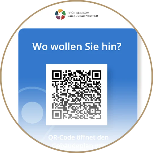
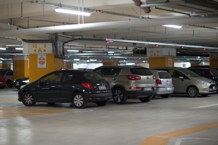
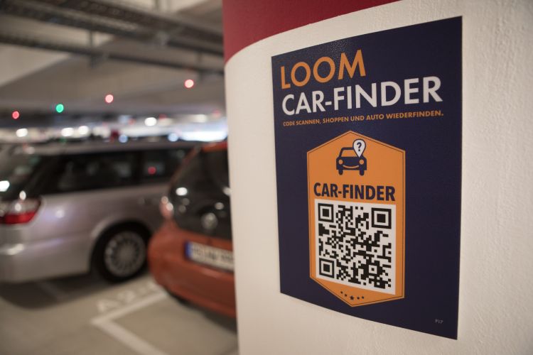
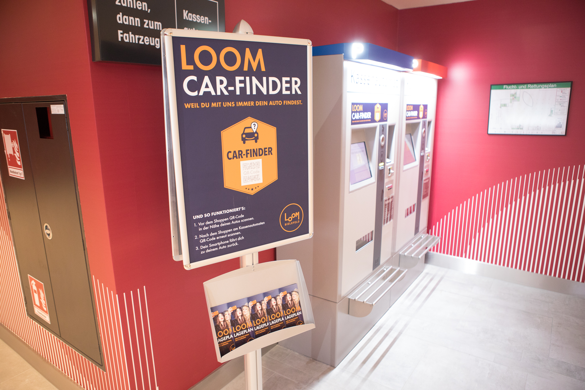
Shopping malls, airports and city centers often offer a multitude of parking spaces – which is convenient for the customer, but can quickly become a nuisance… “Where did I park my car again?” The carFinder guides the user unerringly back to the car. Accurate to the meter, self-explanatory and available on any mobile device without installation. By placing QR codes, users are navigated to their cars.
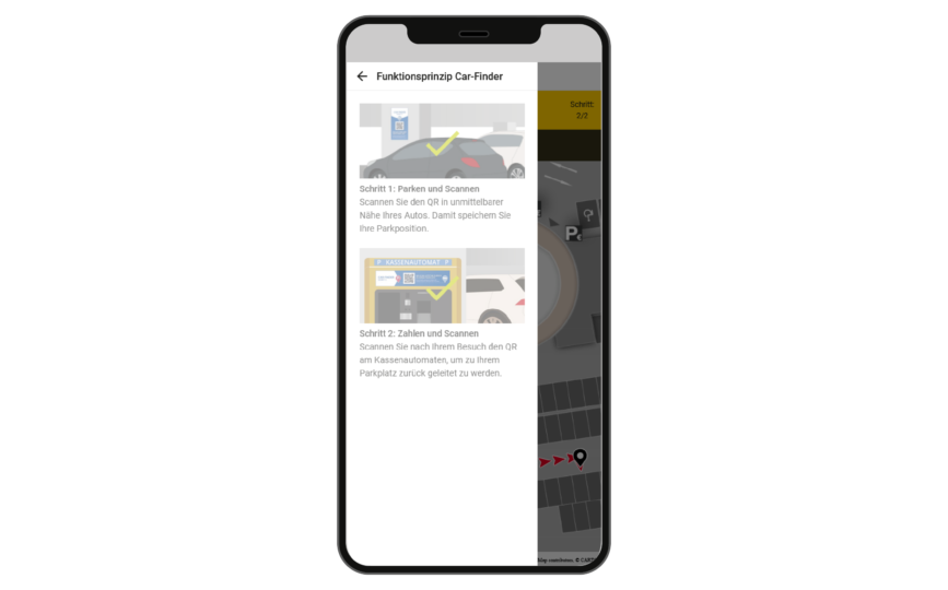
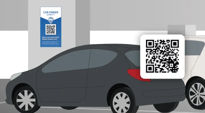
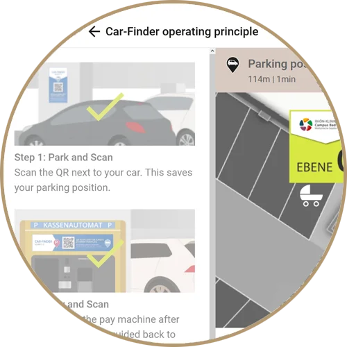
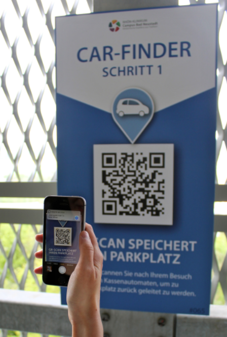
Scan the QR in the immediate vicinity of your car. This will save its parking position.
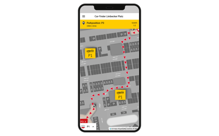
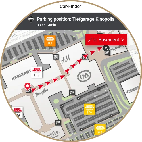
The application displays the saved parking position on the map, along with the indication of what the next step is.The carFinder can be used installation-free in the browser of your smartphone.
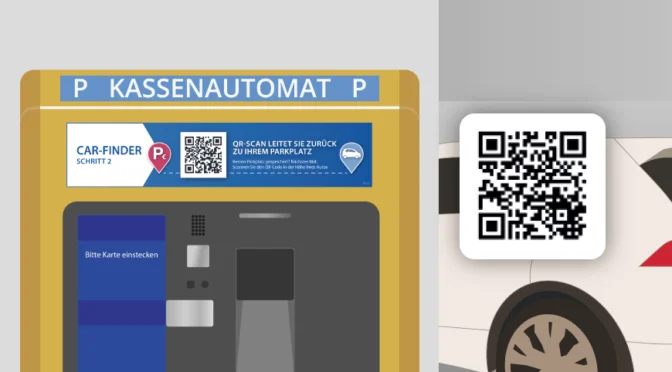
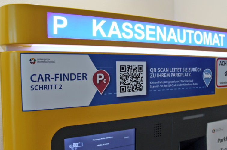
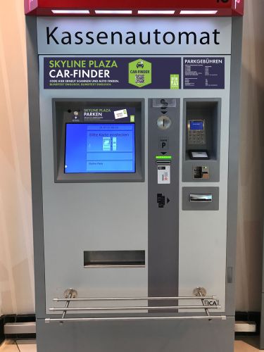
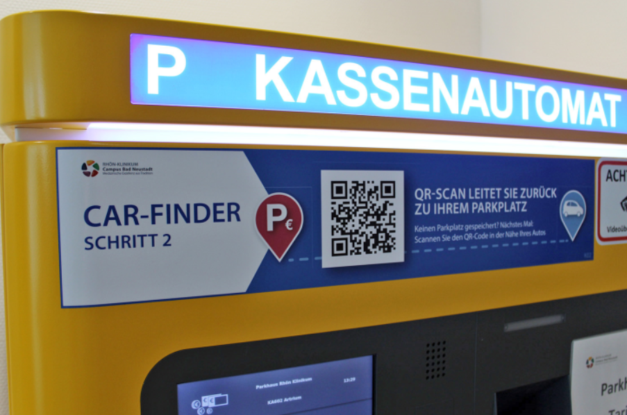
STEP 2: Pay & SCAN
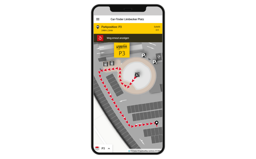
After your visit, scan the QR on the pay station to be directed back to your car. After the second scan, you will be shown step by step the route from the pay station you are at to your car.
In addition, you will receive information such as the saved parking position, the distance and the duration of the route.
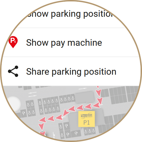
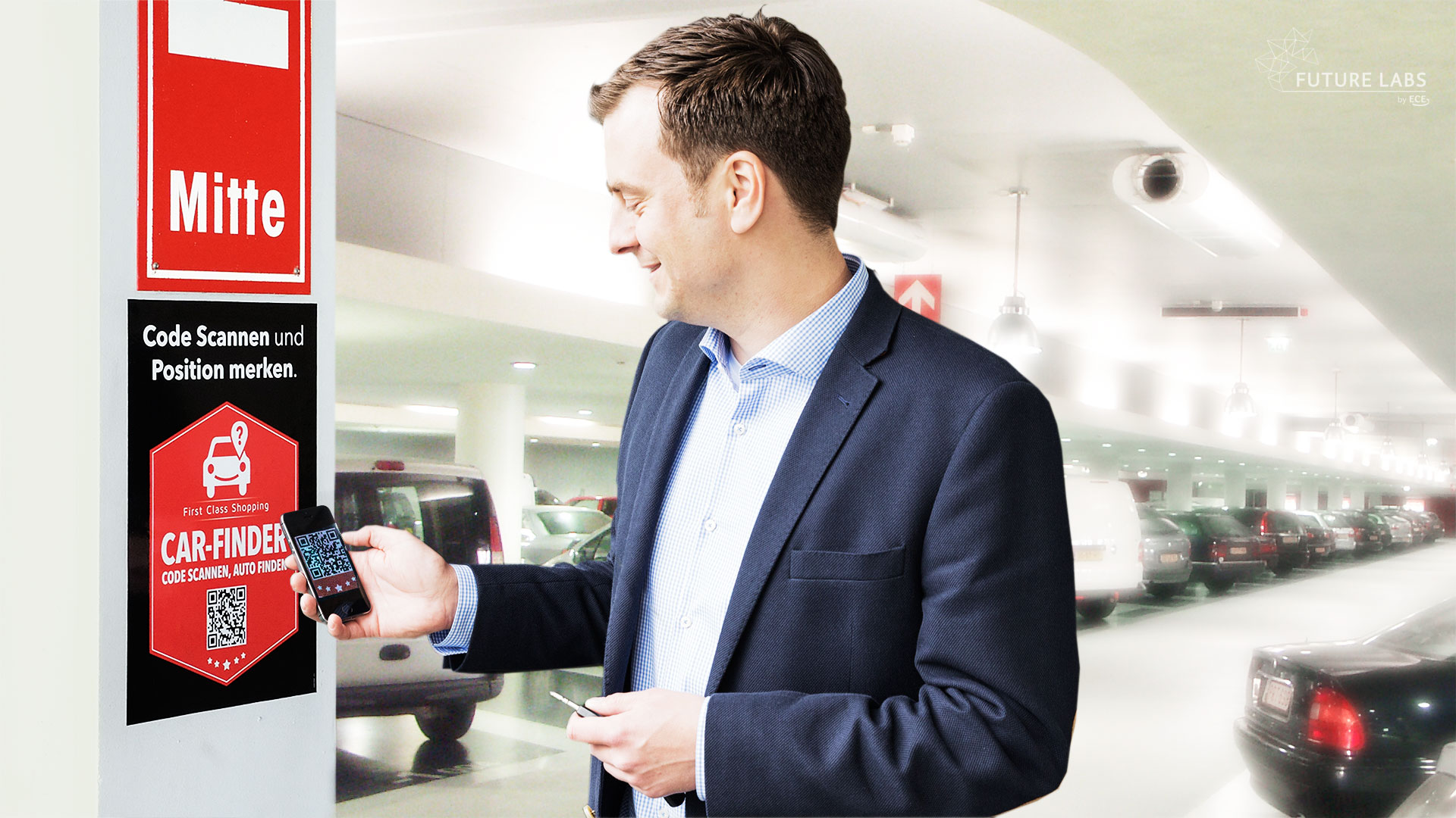
After the visit, a second QR code is scanned at the pay station or at the entrance to the parking garage. The current location and the saved parking position are now set and the way back to the car is displayed on the map step-by-step in an understandable way.
The map display is not limited to simple lines and areas: Many years of experience in cartography are incorporated into the design. For example, exterior walls are reinforced, interior walls are designed with drop shadows for a vivid impression of depth. Parking entrances are indicated by arrows, walking surfaces are highlighted in color, and important identifying features such as stairs, elevators, and parking markers are drawn in to help convey wayfinding information.
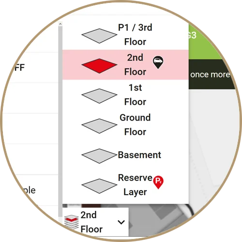
The interactive map offers not only the familiar gestures for zoom & pan but also a convenient control for floor selection.
The map is geo-referenced and created to scale based on CAD drawings, making it ready for indoor positioning navigation (IPS-ready).
The fastest or an easy to remember path is calculated instead of just the shortest one. This is done by weighting path sections, e.g. to favor large walking corridors.
Obstacles such as (rolling) stairs are taken into account for barrier-free routing and alternative paths via elevators and ramps are displayed. Monodirectional paths (turnstiles, escalators, security gates, etc.) can also be entered.
Temporary (e.g. elevator repair) or dynamic (e.g. waiting time at security check) events as well as user profile-dependent factors (staff vs. visitors) determine the routing.
The path is conveyed via an easy-to-understand step-by-step path display with automatic focus on the respective path section. The animated path illustrates the direction of travel. Precise time and distance information tells the user how long it will take to reach the car.
Text contents are saved in Unicode format (UTF-8). Thus, not only special characters are no problem, but also characters of non-Latin languages such as Chinese.
In addition to right-to-left writing, the writing direction from right to left can also be used, as it is used in the Arabic script, for example.
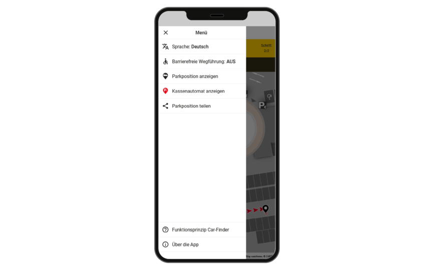
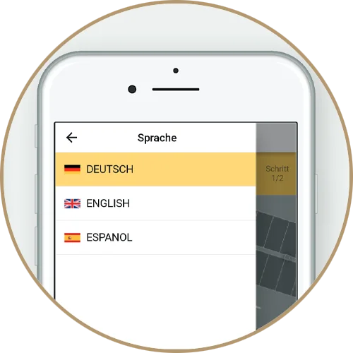
German and English as well as another language – which is provided by the customer – are included in the scope of delivery.
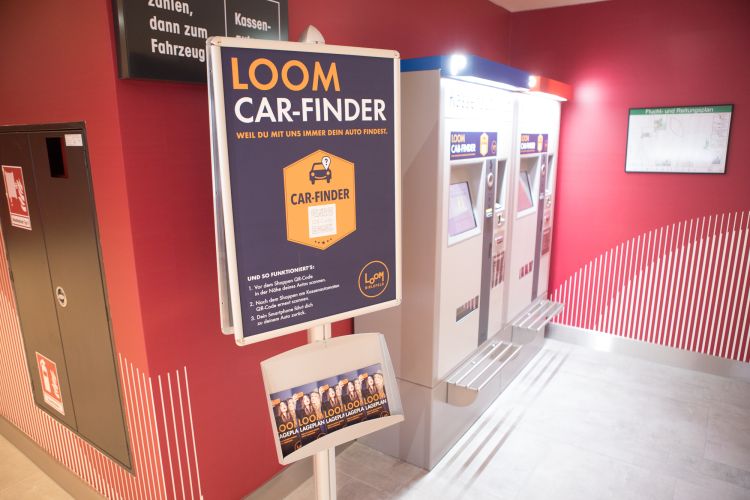
The design of the signage in the parking garage and at the pay stations is crucial to ensure that the user is made aware of, understands and uses the carFinder. A simple standard design is included in the scope of delivery. To incorporate your own corporate identity, a customized sign design can be created.
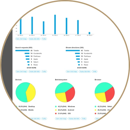
With this extension, important operator inputs are logged anonymously. In our service center, these can be analyzed by the customer in the form of statistics. Here the user receives information about the use and utilization of the carFinder. The period of observation (from/to, day/time) can be freely selected. This also allows general conclusions to be drawn, such as the utilization of parking spaces per time of day.
Since no personal data (such as IP address or fingerprinting) is collected and no technologies (such as cookies) are used to recognize returning users, the statistics are in compliance with the General Data Protection Regulation (DS-GVO).
Custom Sign Design
Statistics
Product properties
Project scope: Parking garages & parking lots
Building sizes: All
Wayfinding: 2D or 3D
Search categories: No
Target highlighting: target marker
Devices: Mobile
Map display: Simplified
Scope of delivery: QR code image file
from 6.000 €
This website uses cookies so that we can provide you with the best user experience possible. Cookie information is stored in your browser and performs functions such as recognising you when you return to our website and helping our team to understand which sections of the website you find most interesting and useful.
Strictly Necessary Cookies
Strictly Necessary Cookie should be enabled at all times so that we can save your preferences for cookie settings.
If you disable this cookie, we will not be able to save your preferences. This means that every time you visit this website you will need to enable or disable cookies again.
Additional Cookies
This website uses the following additional cookies:
(List the cookies that you are using on the website here.)
Please enable Strictly Necessary Cookies first so that we can save your preferences!


